The idea of a secret public transportation system that only a small, technocratic elite knows about has something of the Knight Bus about it, but it’s a reality here in San Francisco, where thousands of commuters go to their jobs thirty to fifty miles south in Silicon Valley on ultra-secret bus lines. And yes, Apple — of course! — runs one.
A year ago, design firm Stamen got a grant to make an art project in which they mapped the “secret” bus routes of companies like Google, Apple, Facebook, Yahoo and more. Although these buses — massive double-deckers with tinted windows, reclining chairs and WiFi that struggle up and down San Francisco’s scenic bay-side hills — are regular sights on the city streets, their routes aren’t publicized by companies who fear that the regular hoi polloi will try to board them.
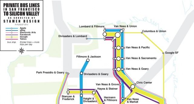
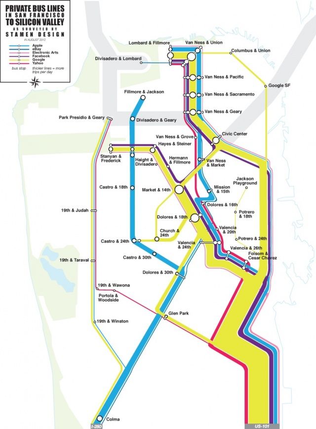
Using their grant, then, Stamen decided to try to map these buses’ routes. The result is the striking map you see below:
What’s truly astonishing is the sheer scale of these bus lines. Stamen explains:
We decided to try some dedicated observation. We sat at 18th & Dolores one morning, and counted shuttles. We counted a new shuttle every five minutes or so; several different companies, high frequency. We also researched online sources like Foursquare to look for shuttle movements, and a 2011 San Francisco city report helped fill in gaps and establish basic routes . . . We enlisted people to go to stops, measure traffic and count people getting off and on and we hired bike messengers to see where the buses went . . . Google alone makes 150 trips daily, all over the city . . .
We wanted to simplify that, to start thinking about it as a system rather than a bunch of buses, so we began paring down the number of stops by grouping clusters where the stops were close to each other. The subway map is the end result of that simplification; it’s not a literal representation, but it’s much more readable than the actual routes. We also wanted to show the relative volumes, so the map segments are scaled by how many trips pass through them; you get a sense for just how much traffic the highways get, and how the routes branch out from there to cover the city. We only mapped San Francisco shuttles, many of these companies operate additional routes in East Bay, the Peninsula, and around San Jose, including direct routes from Caltrain stations to corporate campuses.
The result, in San Francisco at least, is an entire network of transportation that few know about, and is arguably better funded than the city’s own Muni, but which is centered in Silicon Valley, and treats San Francisco itself almost like a set of suburbs to 1 Infinite Loop.


