Apple Maps offers surprisingly great public transport features. It recently expanded transit directions across Europe, so you can get “turn-by-turn” directions for metro, tram and other modes of public transit.
Even if your city isn’t yet covered by these directions, there’s still a whole lot of really useful information available. For instance, just tap a station on the map, and it will show all upcoming departures.
Let’s take a look at Apple Maps public transit features.
Apple Maps transit directions
First, open up the Maps app, and tap on a transit stop. This could be on a metro line or a tram line — it depends what kind of options are available in your city. You’ll see a list of the available lines. When you tap on one of those, you’ll get details about upcoming departures and so on:

Photo: Cult of Mac
This level of detail is easily as good as dedicated apps like CityMapper. And the presentation is a rare case of Apple managing to include a lot of complexity without sweeping it under a virtual rug.
So far, this is the kind of information that you can get in any city. These transit departure details have been available in many European cities since before the new transit-directions rollout.
Transit ‘turn-by-turn’
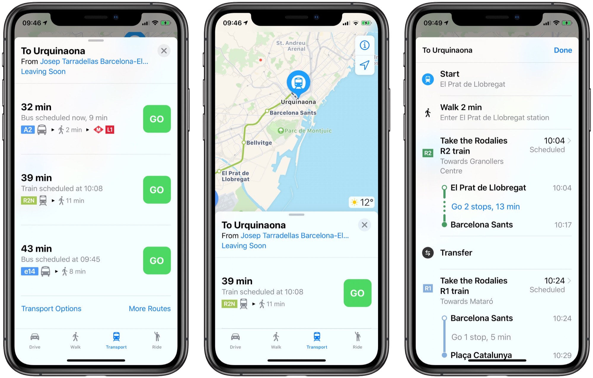
To get transit directions, just enter a search and hit the Directions button. If you see walking or driving directions, tap the blue Transport button at the bottom of the list. You’ll see a list of possible routes.
Like any good transit app, the options are multi-modal. In this example, a trip from Barcelona’s El Prat airport to the city center offers buses and trains, followed by the metro. Options include the privately operated Aerobus, as well as the train and a regular (tourist-free, and much cheaper) bus route.

Photo: Cult of Mac
Tap your preferred route, and you’ll get a detailed breakdown of the journey. Hit Go, and you’ll enter the turn-by-turn section of the Maps app. The best part of using Apple Maps in this way is that it integrates perfectly with your Apple Watch.
Also essential in any transit app is details about outages and delays. So far, I’ve seen a few route changes and outages, and the Maps app presents them clearly. Route changes are presented in-line with your route details, showing you if a line is skipping certain stops, for example.
It seems that Apple Maps is doing a better job of translating these interruptions into English than CityMapper. On the other hand, CityMapper only shows you outage details if the interruption is actually on your journey — Apple will inform you if it occurs anywhere on a line you will be using.
Apple Maps — good enough at last?
I avoid Google Maps if at all possible, and I love CityMapper. But it looks like Apple Maps is now good enough for getting around big cities. One huge advantage is that you can get transit directions from any map view on the Mac or iOS. For instance, if you use the look-up feature to preview an address in, say, the Mail app, you can now get directions. If you want to see the same journey in an app like CityMapper, you’ll need to copy and paste the address.
The only thing missing in Apple Maps now is cycling directions. Maybe in a few more years. At least you can use your iPhone or Apple Watch to pay for your tickets.


