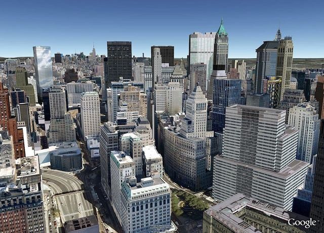
With iOS 6, Apple is looking to replace Google Maps with their own Cupertino solution that also provides 3-D maps of cities across the globe. Google isn’t going down without a fight though, so they just updated their Google Earth app for iOS to include 3-D maps before people get comfy with Apple’s Flyover solution in iOS 6.
Some Android phones have had Google’s 3-D maps since June, but the amount of cities rendered in 3-D is currently limited to only 14 regions. Right now users can get flyover type views of Los Angeles, San Francisco, Boston, and a few other areas.
Google plans to have coverage for over 300 million people globally by the end of 2012, which really isn’t that much when you consider that large metropolitan areas can account for about 10million people each. Still, it’s a great start and Google will continue to quickly add cities over time, just like they have with their Google StreetView feature.
Rendering the polygons of Google’s 3D maps takes a lot of horsepower, so the feature will only be available to iPhone 4S users. Other iPhones running iOS 4.2 will get all the other new features in the app update.
In an interview with CNET about the 3D Maps update, Google’s Geo Team Product Manager, Peter Birch said
“We love maps here, and we are really trying to build the best, and most useful and comprehensive maps that we can, and to make that available to our users wherever they are.”
However, there’s no official word yet on whether or not Google plans to release a separate iOS Google Maps app once iOS 6 is released and Google’s Maps are replaced with Apple’s own solution.
Source: CNET


